Carlson Precision 3D Topo 2023 (81058) Win x64

Free Download Carlson Precision 3D Topo 2023 (81058) | 825.0 mb
Owner:Carlson Software Inc.
Product Name:Carlson Precision 3D Topo
Version:2023 (81058) *
Supported Architectures:64
Website Home Page :www.carlsonsw.com
Languages Supported:english
System Requirements:Windows **
Size:825.0 mb
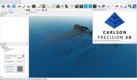
Carlson Software is pleased to announce the availability ofCarlson Precision 3D Topo 2023 (81058)is a software with an array of tools to locate and correct DTM errors in a sharp, 3D interface.
– More features are multi-threaded and optimized for faster operation. Point clouds will load and merge faster, point cloud smoothing, simplification and surface creation is faster.
– Cropping out a group of points now lets the user move or copy these points to a new point cloud instead of deleting them.
– Clouds can be cropped during import with area-of-interest polylines.
– A point cloud can now be colorized with an image or google map download.
Point Cloud Filtering– all commands within this series have been set up to run on the entire cloud or to run just inside one or more selected closed polylines, allowing the user to target different problems in a cloud with different simplification techniques merely by selecting different polylines.
Smoothing filtershave been optimized to do a better job faster.
Adjust Cloud Elevation– this command uses one or more field survey points to make one vertical adjustment to a point cloud. If more than one point is used, variation and standard deviation information is displayed in the Output Window and can be cut and pasted for quantifying point cloud accuracy to a survey.
Bare Earth Filter– now you can save non-ground points that are stripped when the filter is run, allowing the user to look at what was removed and merge any portions back into the working cloud if the filter was too aggressive in specific areas. The Slope parameter may now be displayed in percentage, degrees, or a ratio. The filter has been rewritten to do a better job and run more quickly. Click here to see how this works on YouTube.
TheResample Gridis "smart". While the software attempts to push the grid to the setting, it will not skip over critical points to get to the grid spacing, it will preserve high points, low points, edges for a more accurate surface downstream.
TheOutlier filternow has user parameters allowing the setting of a minimum distance to another point and a maximum neighbor points for better control of what is considered an outlier.
TheIsolate Pointscommand now has the ability to continue to add points or remove points from the selection set by drawing multiple boxes. Once the selection set is finalized, you can move or create a new cloud from the selection as well as keep only or delete.
TheCrop/Delete by Polylinehas a new feature allowing you to delete every point above or below a user-defined elevation as well as to move or copy points to a new cloud instead of losing them by cropping or deleting.
Undois much more powerful, allowing you to quickly "start over" if you don’t like the results of a command.
Google Map overlayscan be accessed by address or will automatically download the current area of interest if a point cloud, surface or linework exists in the scene. Kentucky users can now download state LIDAR by address or tile numbers.
Surfaces:
– Creating a TIN from a point cloud is faster with more control of hole size and odd shaped clouds.
– Add Breaklines has been completely revised with the ability to process multiple, interrelated breaklines at the same time, processing lines first, then closed polylines with the ability to remove all points within a closed polyline – great for modeling ditches and ponds as well as more traditional uses of breaklines.
– Surface Merging now has buffer control to improve the blending of an interior surface, such as a design road into a surface created from state provided LIDAR.
– Contour lines have more control – you can now specify a start elevation for contouring to begin. Additionally, you can create polylines from generated contours for export.
– You can now create a point cloud from a surface, allowing the user to work back and forth between clouds and surfaces to get a desired result or to clean up old TIN surfaces using cloud tools.
– Rather than draping on import, images can now be simply dragged and dropped from the Scene Explorer onto the surface to colorize the TIN.

Carlson Software’s revolutionary Precision 3D platformcombines the easy and delight of a completely 3D environment with the rigor and precision of sophisticated engineering tools. Much more than 3D just as a visualization tool, the software utilizes the newest technologies to allow users to easily combine data from a wide variety of sources to create high fidelity 3D surfaces (P3D Topo) and hydrology-related deliverables (P3D Hydro). Your 3D designs are drawn automatically to CAD, creating the deliverables you need while working in a more faster, more intuitive 3D environment.
Carlson Precision 3D
Founded in 1983,Carlson Software Inc.specializes in CAD design software, field data collection, laser measurement and machine control products for the civil engineering, surveying, GIS, construction, and mining industries worldwide, providing one-source technology solutions for the entire project cycle. Carlson Software is headquartered in Maysville, Ky., U.S.A., with branch offices in Boston, Mass.; Almere, The Netherlands; Brisbane, Australia; Ottawa, Canada; and York, England.
DONWLOAD FROM RAPIDGATOR–>Click Link PeepLink Below Here Contains Rapidgator
http://peeplink.in/429a3c63a229
DONWLOAD FROM UPLOADGIG
3kkh4.Carlson.Precision.3D.Topo.2023.81058.rar
DOWNLOAD FROM NITROFLARE
3kkh4.Carlson.Precision.3D.Topo.2023.81058.rar
